
Title or Question
Describe the item or answer the question so that site visitors who are interested get more information. You can emphasize this text with bullets, italics or bold, and add links.Title or Question
Describe the item or answer the question so that site visitors who are interested get more information. You can emphasize this text with bullets, italics or bold, and add links.Title or Question
Describe the item or answer the question so that site visitors who are interested get more information. You can emphasize this text with bullets, italics or bold, and add links.
Coming to Australia | April 2024
Discover
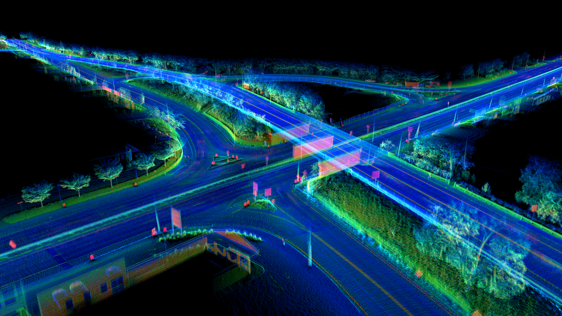
AI-Powered Mapping for Infrastructure
Our upcoming cutting-edge platform, backed by new AI technology, offers a suite of digital transformation solutions designed to reshape how you map and manage the built world.
Key Features
At CivilTech Solutions, our mission is to connect the physical and digital worlds for governments, engineers, infrastructure owners, and more.
Infrastructure is the backbone of society, connecting people, driving the supply chain, enabling employment, healthcare, education, and much more. However, despite its critical importance to our day-to-day lives, it has been neglected and overlooked for far too long.
While dozens of industries, like healthcare, finance, IT, and more, have seen digital transformations over the last few decades, the way the world manages its roads, sidewalks, bridges, trees, and related physical infrastructure has remained largely unchanged.
3 Simple Steps
Vehicle-Mounted Sensor
Automate 3D LiDAR and street view imagery data capture for large projects at normal driving speeds.
AI Data Processing
Build a classified 3D model using 3D LiDAR scans, high-resolution imagery, and GPS for inventories, change detection, and measurements.
Actionable Results
Quickly access results via our web-based platform and integrate data into existing software effortlessly.
Benefits of our solutions
- Seamless integration into current operations
- Affordable and scalable solutions
- Digital data formats ensure all information is easily accessible
- Detailed, quick, and accurate data collection and analysis
- Easily export and integrate data into industry-standard software
Tailor Your Services
Discover how CivilTech Solutions streamlines infrastructure inspections, saves time, and improves safety with our advanced technologies. Book a demo now to learn more.
